Marine Navigation Equipment Details: Exploring Components and Navigation Methods
Marine navigation equipment helps vessels determine position, direction, distance, speed, and surrounding conditions while traveling across oceans, coastal waters, rivers, and ports.
Modern navigation combines electronic systems with traditional methods to support safe and organized movement at sea. Although equipment such as radar, GPS, electronic charts, and compasses is central to navigation, related testing equipment also plays a role in checking the condition of components exposed to pressure, water, and demanding marine environments.
Context
Understanding Marine Navigation Equipment
Marine navigation equipment refers to the instruments and electronic systems used to understand a vessel's location and movement. A basic navigation setup may include a magnetic compass, charts, depth measurement instruments, radar, satellite positioning receivers, and communication equipment.
Traditional navigation depended heavily on visual landmarks, celestial observations, magnetic direction, and manually calculated distances. Modern vessels can combine satellite positioning, digital charts, radar information, and sensor data to create a more detailed picture of their surroundings.
Navigation systems are used on many types of vessels, including cargo ships, passenger vessels, fishing boats, research vessels, naval vessels, and recreational boats. The exact equipment varies according to vessel size, operating environment, voyage requirements, and regulatory expectations.
Main Navigation Components
Common marine navigation components include:
- Magnetic compass: Provides directional information using Earth's magnetic field.
- GPS or GNSS receiver: Determines geographic position using satellite signals.
- Marine radar: Detects nearby objects and helps estimate their distance and direction.
- Electronic chart systems: Display digital representations of waterways, coastlines, hazards, and navigational information.
- Depth sounder: Measures water depth beneath or near a vessel.
- Gyrocompass: Provides directional reference without relying on magnetic north.
- Automatic identification system: Exchanges information about vessels, including identity, position, course, and speed.
- Speed and distance sensors: Help estimate vessel movement through the water.
These systems can work independently or together. When several sources of information are available, navigators can compare them to identify differences or potential errors.
Where Pressure Testing Fits
Marine equipment may include pipes, tanks, hydraulic components, valves, hoses, and other systems that operate under pressure. A pressure testing machine can be used in controlled testing environments to determine whether a component can withstand a specified pressure level.
Pressure test equipment can also be relevant when inspecting systems associated with navigation-supporting infrastructure. For example, certain vessels contain pressurized systems that require examination before equipment is placed into operation or after maintenance.
Pressure testing equipment is not itself a navigation instrument. Instead, it belongs to the wider group of inspection and maintenance equipment that can help verify the condition of vessel systems. High pressure testing equipment is designed for applications where testing requires controlled pressure levels and appropriate safety procedures.
Importance
Supporting Situational Awareness
Navigation equipment helps crews understand what is happening around a vessel. Position information can be compared with electronic charts, radar observations, depth measurements, and visual observations.
This combination is particularly important in areas where visibility is limited or where traffic, shallow water, restricted channels, or offshore structures create additional navigation challenges.
Reducing Navigation Uncertainty
A vessel's position can change continuously because of its own movement, wind, currents, and other environmental conditions. Navigation systems provide information that helps crews monitor these changes.
Electronic positioning does not eliminate the need for human judgment. Navigators generally consider multiple information sources because individual sensors can experience signal interruptions, measurement errors, equipment faults, or environmental interference.
Supporting Equipment Reliability
Marine environments expose equipment to saltwater, humidity, vibration, temperature changes, mechanical loads, and continuous operation. Regular inspection helps identify potential weaknesses before they become more significant equipment problems.
Pressure testing can be relevant to this wider maintenance process. Depending on the component and applicable procedures, pressure test equipment can help assess whether pipes, tanks, valves, or other pressure-containing systems maintain their expected integrity.
Navigation Methods in Practice
Different navigation methods continue to have specific roles:
| Navigation method | Main information provided | Typical application |
|---|---|---|
| Satellite navigation | Geographic position and time | Open water and coastal navigation |
| Radar navigation | Distance and direction of objects | Traffic and low-visibility conditions |
| Electronic charts | Digital geographic information | Route planning and position monitoring |
| Magnetic compass | Direction | Backup and general orientation |
| Celestial navigation | Position using celestial observations | Independent navigation reference |
| Depth measurement | Water depth | Shallow-water and channel awareness |
| Visual navigation | Landmarks and physical references | Coastal and harbor areas |
Using more than one method provides additional context when interpreting the vessel's position and surroundings.
Recent Updates
Greater Use of Integrated Navigation
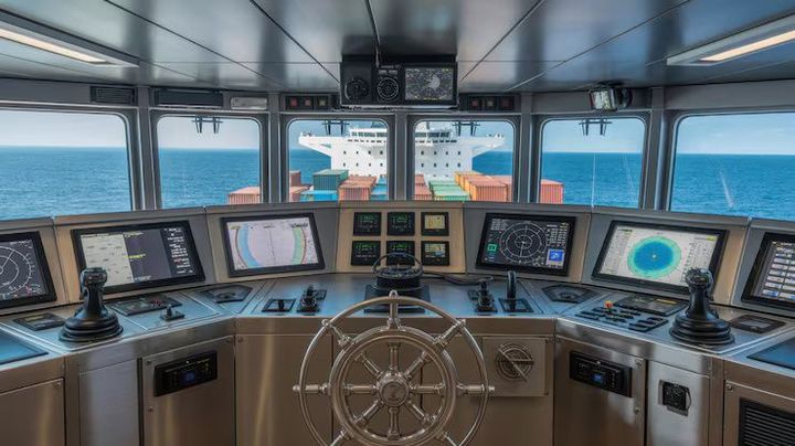
Marine navigation has increasingly moved toward integrated digital systems. Modern bridges can combine positioning, radar, electronic charts, vessel information, heading data, and other sensor inputs on connected displays.
This approach can reduce the need to interpret each information source separately. At the same time, greater system integration means that crews need to understand how different sensors and electronic systems interact.
Improvements in Positioning and Sensors
Satellite navigation continues to develop through the availability of multiple satellite constellations and improved receiver capabilities. Multi-constellation systems can use signals from different global navigation satellite systems, providing additional positioning sources.
Sensor technology has also become more connected. Digital data from heading, speed, depth, radar, and positioning systems can be shared between navigation displays and other onboard systems.
Greater Attention to Cybersecurity
The growing use of connected navigation equipment has increased attention to cybersecurity. Navigation systems may exchange information across onboard networks, making system configuration, software management, access controls, and operational procedures relevant considerations.
The broader trend is toward treating navigation as a combination of physical equipment, digital information, human decision-making, and system management rather than as a collection of isolated instruments.
More Structured Equipment Testing
Marine maintenance practices also continue to emphasize documented inspection and testing. Pressure testing equipment can be part of controlled procedures for particular pressure-containing systems, while high pressure testing equipment may be used where higher test pressures are specified by the relevant technical procedure.
Testing requirements depend on the equipment, vessel, application, and applicable standards. Testing should therefore be conducted using procedures appropriate to the specific component.
Tools and Resources
Navigation Planning Tools
Common navigation resources include electronic chart systems, nautical charts, satellite navigation receivers, radar displays, tide information, weather information, and voyage-planning software. These resources help organize geographic and environmental information before and during a voyage.
Measurement and Testing Equipment
Marine operators may also work with specialized measurement equipment for maintenance and inspection. Depending on the system being examined, this can include pressure gauges, calibrated measurement devices, leak-testing equipment, pressure testing machines, and other inspection instruments.
Useful resources can include:
- Nautical chart references for geographic information
- Electronic navigation systems for route planning
- Maritime weather platforms for environmental information
- Tide and current tables for water-level planning
- Equipment manuals for operating procedures
- Inspection templates for recording maintenance activities
- Pressure testing documentation for recording test conditions and results
The appropriate resource depends on the vessel, equipment type, operating environment, and applicable technical requirements.
FAQs
What is marine navigation equipment?
Marine navigation equipment consists of instruments and electronic systems that help determine a vessel's position, direction, speed, depth, and surrounding conditions. Common examples include GPS or GNSS receivers, radar, compasses, electronic charts, and depth sounders.
What is a pressure testing machine used for?
A pressure testing machine is used to apply controlled pressure to a component or system during an inspection or testing procedure. It may be relevant to pipes, tanks, valves, hoses, and other pressure-containing equipment rather than to navigation itself.
Where is pressure test equipment used on vessels?
Pressure test equipment can be used when examining suitable pressure-containing systems, such as piping, tanks, valves, and hydraulic components. The exact application depends on the component and the testing procedure.
What is pressure testing equipment?
Pressure testing equipment refers to devices used to apply, measure, control, or monitor pressure during a controlled test. Equipment may include pumps, gauges, test connections, monitoring instruments, and related components.
Why is high pressure testing equipment important?
High pressure testing equipment is used for applications where a controlled test requires pressure above ordinary operating levels. Appropriate procedures, equipment ratings, measurement accuracy, and safety controls are important when conducting such tests.
Conclusion
Marine navigation equipment combines traditional instruments with electronic systems to help vessels determine position, direction, depth, speed, and surrounding conditions. Radar, satellite positioning, electronic charts, compasses, and sensors each provide different forms of navigational information. Pressure testing equipment belongs to the broader inspection and maintenance environment rather than direct navigation, but it can be relevant to pressure-containing vessel systems. Current marine technology increasingly combines navigation data, connected sensors, digital planning, and structured equipment testing within integrated operational environments.


