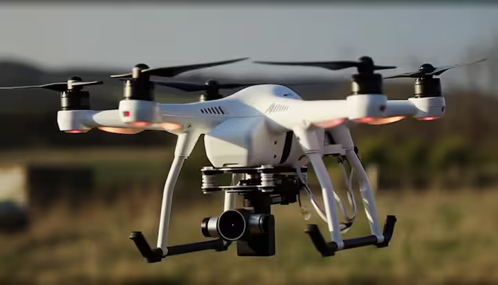
Drone Technology: A Complete Guide to How Drones Work, Uses, Costs, and Future Trends
Drone technology has developed from a specialized aerospace concept into a practical tool used in photography, agriculture, construction, surveying, infrastructure inspection, logistics research, environmental monitoring, and many other industries. Modern drones combine lightweight aircraft structures with cameras, sensors, navigation systems, software, and wireless communication.
For businesses and professionals, understanding drone technology is important because unmanned aircraft can collect information quickly and efficiently while reducing the need for people to physically access difficult or hazardous locations.
This guide explains how drones work, the major types of drones, their applications, operating costs, safety considerations, regulations, and emerging trends.
What Is Drone Technology?
Drone technology refers to the combination of hardware and software used to operate an unmanned aerial vehicle (UAV). A drone can fly without a pilot physically sitting inside the aircraft. Depending on its design and purpose, it may be controlled remotely by an operator or use automated flight systems.
A typical drone can include:
- Flight controllers
- Electric motors
- Propellers
- Batteries
- GPS or other navigation systems
- Cameras
- Sensors
- Wireless communication equipment
- Obstacle detection systems
- Flight planning software
- Data processing software
Consumer drones are commonly used for recreational flying and photography, while professional UAV systems can support aerial surveying, mapping, inspection, agriculture, construction, and industrial data collection.
How Do Drones Work?
A drone operates through the interaction of several electronic, mechanical, and software systems.
Flight Controller
The flight controller is essentially the central control system of a drone. It processes information from sensors and adjusts the motors to maintain stability and control movement.
For example, when a quadcopter needs to move forward, the flight controller changes the speed of individual motors to alter the aircraft's orientation.
Motors and Propellers
Most small commercial drones use electric motors. In a multirotor drone, several motors work together to generate lift and control movement.
The number and arrangement of motors depend on the aircraft design. Quadcopters, hexacopters, and octocopters are common configurations.
Navigation Systems
Navigation technology helps drones determine their position and maintain planned flight paths. GPS and other positioning technologies are widely used in commercial UAV systems.
More advanced systems can combine satellite positioning with inertial sensors, cameras, and other technologies to improve navigation.
Cameras and Sensors
Modern drones can carry different payloads depending on their purpose.
Common payloads include:
- High-resolution cameras
- Thermal cameras
- Multispectral sensors
- LiDAR systems
- Infrared sensors
- Environmental sensors
These technologies allow drones to collect information beyond ordinary photographs.
Types of Drones
There are several categories of drones, and each is designed for different operating requirements.
Multirotor Drones
Multirotor drones are among the most recognizable UAVs. They use multiple propellers to generate lift and control the aircraft.
Their ability to take off and land vertically makes them useful for:
- Photography
- Building inspections
- Construction monitoring
- Real estate imaging
- Surveying
- Infrastructure inspection
Fixed-Wing Drones
Fixed-wing UAVs resemble traditional airplanes. Their wings generate lift while the aircraft moves forward.
They can be useful when large areas need to be surveyed because they can generally cover greater distances more efficiently than many multirotor platforms.
Hybrid VTOL Drones
Hybrid vertical-takeoff-and-landing drones combine characteristics of multirotor and fixed-wing aircraft.
They can take off vertically and then transition to forward flight. This design can be useful for applications requiring both flexible launch capabilities and longer-distance aerial coverage.
Commercial Applications of Drone Technology
Drone technology is increasingly used in commercial and industrial environments.
Drone Surveying and Mapping
Surveying is one of the most important professional applications of UAV technology.
A drone equipped with a suitable camera or LiDAR sensor can capture large numbers of aerial measurements. Specialized software can then process the data into maps, models, orthomosaics, or three-dimensional representations.
Drone surveying may be useful for:
- Land surveys
- Construction sites
- Mining areas
- Topographic mapping
- Infrastructure projects
- Site planning
Professional surveying still requires appropriate expertise, equipment, quality control, and compliance with applicable regulations.
Construction Monitoring
Construction companies can use drones to document project progress from above.
Regular aerial surveys can provide visual records of a site and help project teams compare current conditions with earlier observations.
Potential uses include:
- Progress documentation
- Site inspections
- Stockpile measurements
- Roof inspections
- Project visualization
- Construction site mapping
Drone data can complement traditional construction management systems rather than replacing professional inspections in every situation.
Agriculture and Precision Farming
Agricultural drones can collect information about crops and farmland using conventional, multispectral, or thermal imaging.
This information can help farmers and agricultural professionals study:
- Crop health
- Irrigation patterns
- Plant stress
- Field conditions
- Crop variability
When combined with other agricultural data, aerial imagery can support more informed farm management decisions.
Infrastructure Inspection
Drones can provide aerial imagery of infrastructure that may otherwise be difficult or expensive to inspect.
Potential applications include:
- Bridges
- Solar installations
- Wind turbines
- Telecommunications infrastructure
- Industrial facilities
- Roofs
- Power infrastructure
Drone inspections can reduce the amount of time personnel need to spend accessing difficult locations, although qualified professionals may still be required for detailed physical or structural assessments.
Real Estate Photography
Real estate professionals increasingly use aerial photography to present properties and surrounding areas.
Professional drone photography can provide:
- Aerial property views
- Neighborhood perspectives
- Large-property imagery
- Site context
- Marketing photography
Operators must follow applicable aviation and privacy requirements when capturing and publishing aerial images.
Drone Software and Data Processing
Hardware is only one part of modern drone technology. Software plays an increasingly important role.
Flight Planning Software
Flight planning applications can help operators define routes, altitude parameters, camera settings, and other mission requirements.
Automated flight planning can make repetitive data-collection missions more consistent when used correctly.
Drone Mapping Software
Mapping platforms process aerial images and sensor data into useful digital outputs.
Depending on the system, these may include:
- Orthomosaic maps
- 3D models
- Point clouds
- Digital elevation models
- Measurement data
- Survey reports
Businesses should evaluate software based on factors such as accuracy requirements, processing capabilities, data security, compatibility, and licensing costs.
Drone Fleet Management
Organizations operating multiple UAVs may use drone fleet management software to organize aircraft, pilots, maintenance records, flight information, and operational documentation.
Fleet management becomes increasingly important as businesses move from occasional drone flights to structured commercial operations.
Drone Technology Costs
The cost of operating a drone varies considerably depending on the aircraft, payload, software, training, maintenance, insurance, and regulatory requirements.
Drone Hardware Costs
Basic consumer drones can be relatively affordable, while professional UAV platforms can cost significantly more.
Commercial systems may require additional equipment such as:
- Professional cameras
- LiDAR sensors
- Thermal cameras
- Additional batteries
- Charging equipment
- Ground control equipment
- Transport cases
Drone Software Costs
Professional drone operations may also require paid software for:
- Mapping
- Photogrammetry
- Data analysis
- Flight planning
- Fleet management
- Asset inspection
Some software providers use subscriptions, while others offer perpetual licenses or usage-based pricing.
Drone Insurance
Commercial operators may consider drone insurance to manage certain financial risks associated with UAV operations.
Coverage requirements vary by location, business activity, aircraft type, and insurer. Potential insurance products can include liability coverage and other forms of aviation-related protection.
Businesses should carefully review policy terms, exclusions, coverage limits, and applicable legal requirements before purchasing insurance.
Drone Safety and Risk Management
Safe drone operations require more than simply learning how to control an aircraft.
Pre-Flight Checks
A professional pre-flight checklist may include:
- Battery condition
- Propeller inspection
- Aircraft condition
- GPS or navigation status
- Weather conditions
- Airspace restrictions
- Communication systems
- Payload security
- Emergency procedures
Weather Considerations
Wind, rain, extreme temperatures, and poor visibility can affect drone performance.
Operators should check reliable weather information and follow the aircraft manufacturer's operating limits before flying.
Privacy and Data Protection
Drones can capture images of people, buildings, vehicles, and private property. Operators should understand applicable privacy and data-protection requirements.
Businesses collecting aerial information should also consider:
- Where data is stored
- Who can access the data
- How long data is retained
- Whether sensitive information is being collected
- How footage is shared
Drone Regulations and Compliance
Drone laws differ between countries and can change over time. Requirements may cover aircraft registration, pilot qualifications, operational limitations, airspace restrictions, identification systems, and commercial operations.
Before conducting a professional drone flight, operators should consult the aviation authority responsible for the area where the aircraft will operate.
In India, drone operations are subject to rules and requirements established under the country's civil aviation framework. Operators should check the latest official requirements before flying because regulations and digital procedures can be updated.
Compliance is particularly important for commercial drone services because a business may have additional responsibilities compared with recreational users.
Benefits of Drone Technology
Drones can provide several practical advantages when used appropriately.
Faster Data Collection
Aerial systems can collect information across large areas in relatively short periods.
Improved Access
Drones can reach locations that may be difficult for personnel to access directly.
Detailed Visual Information
High-resolution cameras and specialized sensors can provide information that is difficult to obtain from ground level.
Potential Cost Efficiency
For some inspection, surveying, and monitoring tasks, UAV operations may reduce certain labor, access, or equipment costs. The actual financial benefit depends on the project and operating conditions.
Repeatable Monitoring
Businesses can conduct repeated flights using planned routes, making it easier to compare changes over time.
Challenges of Drone Technology
Despite its advantages, drone technology has limitations.
Battery Life
Many electric multirotor drones have limited flight times. Additional batteries and careful mission planning may therefore be necessary.
Weather Sensitivity
Strong wind, precipitation, and extreme weather can restrict operations.
Regulatory Requirements
Operators must comply with aviation rules and may need registrations, permissions, certifications, or other documentation depending on the location and operation.
Data Management
Large drone surveys can produce substantial quantities of photographs, videos, and sensor data. Businesses need appropriate storage and data-management systems.
Skilled Personnel
Professional drone operations can require trained pilots, surveyors, engineers, analysts, or other specialists depending on the application.
The Role of Artificial Intelligence in Drones
Artificial intelligence is becoming increasingly important in UAV systems.
AI-powered technologies can assist with:
- Object detection
- Image classification
- Automated inspection
- Navigation
- Flight planning
- Data analysis
- Anomaly detection
For example, an inspection workflow may use computer vision to identify visual differences in infrastructure images. A qualified professional can then review those findings and determine whether further investigation is necessary.
Future Trends in Drone Technology
The drone industry continues to develop as aircraft, sensors, software, batteries, and artificial intelligence improve.
Autonomous Drone Operations
Future UAV systems are likely to support increasingly sophisticated automated missions while maintaining appropriate human oversight.
Advanced Sensors
Improvements in LiDAR, thermal imaging, multispectral cameras, and other sensors could expand the range of commercial applications.
Drone Delivery Research
Companies and governments continue to research UAV delivery systems for specific logistics applications. Large-scale deployment depends on factors such as regulation, safety, economics, infrastructure, and public acceptance.
Drone-in-a-Box Systems
Automated docking stations can allow certain drones to launch, complete predefined missions, return to a base station, and recharge or undergo servicing.
These systems may be particularly relevant to infrastructure monitoring and industrial inspection.
AI-Based Data Analysis
As drone cameras collect increasingly large datasets, AI-based analytics can help organizations process information more efficiently and identify patterns that deserve human attention.
How Businesses Can Evaluate a Drone Solution
Businesses considering commercial drone services or purchasing their own UAV equipment should begin with the problem they want to solve rather than simply choosing the most advanced aircraft.
Important questions include:
- What information needs to be collected?
- How frequently will flights be required?
- What level of accuracy is necessary?
- Which sensors are appropriate?
- What software is needed?
- What training is required?
- What regulations apply?
- What insurance coverage may be appropriate?
- How will collected data be stored and protected?
- Would purchasing equipment or hiring a drone service provider be more practical?
A clear assessment of these factors can help organizations select technology that matches their actual operational requirements.
Conclusion
Drone technology has evolved into a valuable tool for collecting aerial information, monitoring assets, surveying land, documenting construction, supporting agriculture, and conducting specialized inspections.
The value of a drone is not determined only by its flight performance. Cameras, sensors, software, data analysis, trained personnel, safety procedures, and regulatory compliance all contribute to a successful operation.
As autonomous flight, artificial intelligence, advanced sensors, and drone management platforms continue to develop, UAV technology is likely to become an increasingly important component of modern commercial and industrial workflows.
For businesses considering drone adoption, the best approach is to define the operational objective first and then evaluate the appropriate aircraft, software, training, compliance requirements, insurance, and ongoing operating costs.