Construction Surveying Equipment: A Guide to Modern Surveying Tools
Construction surveying equipment includes the instruments and digital technologies used to measure positions, distances, elevations, angles, and physical features on construction sites.
These measurements help establish where structures, roads, foundations, utilities, and other elements should be placed. Modern construction surveying equipment combines traditional measurement principles with electronic sensors, satellite positioning, digital data collection, and 3D mapping.
The field developed from basic tools such as measuring tapes, levels, chains, and optical instruments. As electronic measurement became more common, total stations, digital levels, and satellite-based positioning expanded the range of information that surveyors could collect. Today, construction surveying instruments may connect directly with computers, tablets, field controllers, and design models.
Land surveying equipment is used across construction, civil engineering, infrastructure development, property measurement, and site preparation. Depending on the project, a survey team may use several instruments rather than relying on one device.
Main Types of Surveying Equipment
Construction survey equipment can be grouped according to how measurements are collected and what information is required. Common categories include:
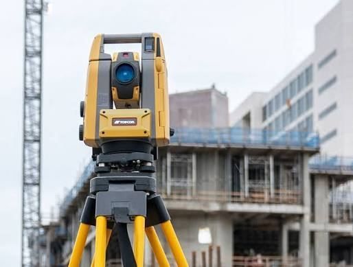
- Total stations for measuring horizontal angles, vertical angles, and distances.
- GNSS receivers for determining geographic positions using satellite signals.
- Digital levels for measuring elevation differences.
- Laser scanners for collecting large amounts of three-dimensional spatial information.
- Construction lasers for alignment, leveling, and layout activities.
- Data collectors and tablets for recording, viewing, and transferring survey information.
Professional surveying equipment may combine several of these functions in one connected workflow. The appropriate instrument depends on site conditions, required accuracy, measurement range, project scale, and the type of information being collected.
How Surveying Supports Construction
Before physical construction begins, surveyors establish reference points that help relate the project design to the actual site. During construction, measurements can be used to check locations, elevations, alignments, and completed work.
For example, total station surveying equipment can measure the position of a point relative to a known reference. GPS surveying equipment, more accurately described in many professional contexts as GNSS equipment, uses signals from satellite navigation systems to determine location. Both approaches have different applications and limitations.
Importance
Accurate measurement is an important part of construction because physical structures must correspond with plans, site boundaries, reference points, and design requirements. Surveying information can influence excavation, foundations, road grades, structural placement, utility installation, and final documentation.
Construction site surveying equipment is therefore used by surveyors, engineers, contractors, inspectors, and other project participants. The information it produces can help different teams work from a common spatial reference.
Improving Measurement and Site Coordination
Traditional measurements can require multiple observations and careful recording. Digital surveying instruments can record measurements electronically, which reduces the need to manually transcribe every field observation.
Robotic total station equipment can automatically track a target in appropriate conditions, while the surveyor controls measurements through a field controller. This can change how field teams organize their work, particularly on sites where repeated measurements are required.
Supporting Three-Dimensional Documentation
3D laser surveying equipment collects numerous points from surrounding surfaces. These points can form a point cloud that represents buildings, terrain, infrastructure, or other physical features.
Three-dimensional data can be compared with design information or used to document existing conditions. Laser scanning is increasingly integrated with conventional surveying rather than being treated as an entirely separate measurement method.
Common Equipment and Uses
| Equipment type | Main measurement or function | Typical construction use |
|---|---|---|
| Total station | Angles and distances | Layout and precise point measurement |
| GNSS receiver | Satellite-based position | Site positioning and control |
| Digital level | Elevation differences | Level and grade measurement |
| Laser scanner | Dense 3D point collection | Existing-condition documentation |
| Construction laser | Alignment and level reference | Interior and site layout |
| Data collector | Field data management | Recording and transferring measurements |
Recent Updates
From 2024 through 2026, construction surveying has continued moving toward connected workflows that combine positioning, scanning, digital models, and field data. Industry research has highlighted integration and data sharing as important technology priorities, while scanning, surveying, and precise positioning remain significant areas of development.
Greater Use of GNSS and Connected Positioning
Advanced GPS construction surveying equipment increasingly works with broader GNSS satellite networks and digital correction methods. GNSS is the wider term because modern receivers can use signals from multiple satellite navigation constellations rather than only the U.S. GPS constellation.
GNSS surveying can face challenges from buildings, trees, terrain, atmospheric conditions, and signal reflections. Developments in receiver technology and processing methods continue to address some of these measurement challenges.
Robotic and Automated Surveying
Professional robotic surveying systems are increasingly connected to digital field workflows. Robotic total stations can track survey targets and communicate with field controllers, reducing the need for some repeated manual operations.
Automated construction surveying systems can also connect measurements with digital designs. This creates a link between field observations and project information, although the level of automation varies considerably between systems and applications.
Combining Total Stations, GNSS, and Scanning
Another development is the combination of several measurement technologies within integrated instruments. Some modern systems combine total station functions, GNSS connectivity, digital imaging, and 3D laser scanning.
This type of sensor integration can reduce the need to switch between separate instruments for certain field activities. It also supports workflows where survey measurements, photographs, and point-cloud information are handled together.
Increasing Role of Digital Models
Surveying data is increasingly connected with digital construction models and field applications. Surveyors can use collected measurements to compare actual site conditions with design information, document as-built conditions, and communicate spatial information between field and office teams.
These developments are also increasing the importance of data formats, interoperability, equipment calibration, cybersecurity, and staff training. Technology alone does not remove measurement errors, so field procedures and quality checks remain important.
Tools and Resources
Several resources can help people understand and organize surveying activities. Equipment manuals explain instrument functions, measurement limitations, setup procedures, and operating conditions. Technical documentation can also provide information about coordinate systems, calibration, accuracy specifications, and data formats.
Planning and Measurement Resources
Useful resources include:
- Survey calculation worksheets for distance, angle, elevation, and coordinate calculations.
- Coordinate conversion tools for working between geographic and projected coordinate systems.
- Survey field-book templates for organizing observations and reference information.
- Equipment calibration records for documenting inspection and adjustment activities.
- Site control templates for recording known points and coordinate information.
- Point-cloud processing applications for viewing and analyzing 3D survey data.
Digital Surveying Platforms
Digital surveying platforms can connect field controllers with total stations, GNSS receivers, scanners, and construction models. They may support functions such as stakeout, coordinate management, surface comparison, field coding, and as-built documentation.
For people researching construction surveying instruments suppliers, manufacturer documentation and technical specification sheets can be useful for understanding measurement ranges, supported satellite systems, data formats, environmental ratings, and compatibility. Independent surveying standards and professional geomatics organizations can provide additional background on measurement practices.
Complete construction surveying equipment systems may combine hardware, field software, controllers, reference equipment, and data-processing applications. The combination varies according to project requirements rather than following one universal configuration.
FAQs
What is construction surveying equipment used for?
Construction surveying equipment is used to measure locations, elevations, distances, angles, and physical features. These measurements support site preparation, construction layout, progress checks, and as-built documentation.
What is the difference between total station surveying equipment and GPS surveying equipment?
Total station surveying equipment measures angles and distances to determine positions relative to known points. GPS surveying equipment, more broadly called GNSS surveying equipment, determines position using satellite signals and related correction methods. Each approach has different strengths depending on the site and measurement task.
What is robotic total station equipment?
Robotic total station equipment is a type of total station that can automatically track a target and be controlled through a field controller. It can support measurement and layout activities while reducing some manual instrument adjustments.
What is 3D laser surveying equipment?
3D laser surveying equipment collects large numbers of measurements from surrounding surfaces to create a point cloud. The resulting data can represent buildings, terrain, structures, and other physical features in three dimensions.
How are advanced construction surveying equipment systems used?
Advanced construction surveying equipment systems can combine total stations, GNSS receivers, scanners, digital controllers, and software. They can connect field measurements with digital designs, mapping information, and project documentation.
Conclusion
Construction surveying equipment has developed from basic optical and manual measurement tools into connected systems that combine electronic measurement, GNSS, robotics, laser scanning, and digital data management. Total stations, GNSS receivers, digital levels, and 3D scanners each address different measurement requirements. Recent developments have focused on integrating these technologies with digital models and connected field workflows. Accurate equipment setup, appropriate measurement methods, calibration, and careful data handling remain important parts of construction surveying.